Orocovis sits at the geographic center of Puerto Rico, surrounded by some of the island’s highest peaks. The terrain here is steep, green, and webbed with rivers. Water collects in the mountains and drops through the valleys in dozens of streams, falls, and natural pools.
If you’re staying in or near the central mountains and want to find rivers and waterfalls near Orocovis, there are a few good options — some easy to reach, others requiring effort. This guide covers the most accessible ones, with honest notes on what to expect.
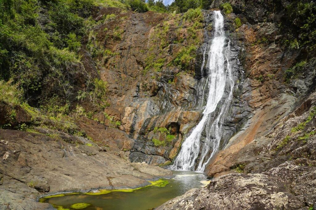
Chorro de Doña Juana
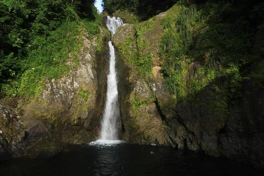
This is the most convenient waterfall near Orocovis. Chorro de Doña Juana sits right along Route 149, around kilometer 41. You can see it from the road.
The falls are composed of three separate chutes with a combined drop of about 100 feet. Water spills down a rocky face into a small pool at the base. The setting is lush — ferns, moss, mist — and the sound of water fills the air even before you see it.
There’s a small turnout for parking, though space is limited. On weekends, the spot draws locals and visitors alike. If you want it quieter, visit on a weekday morning.
A note on swimming: the pool at the base can be reached, but the rocks are slippery and the current changes with rainfall. Most visitors come to look and photograph rather than swim. There’s a small roadside stand nearby where you can grab a drink or snack.
Getting there: From the town of Orocovis, head south on Route 155 until it meets Route 149. Turn toward Villalba and continue until you see the waterfall on your left. The drive takes about 20 minutes.
Salto La Plazuela and Charco El Guitarra
For something more remote, Salto La Plazuela and Charco El Guitarra offer a dramatic payoff — but only if you’re prepared for the access.
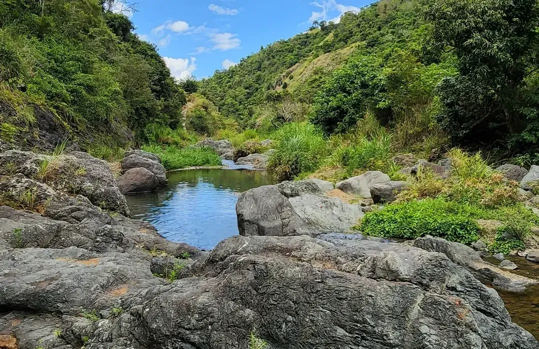
Salto La Plazuela is a towering multi-tiered waterfall deep in the mountains of Orocovis. Below it, the river forms Charco El Guitarra, a large natural pool where locals swim when conditions allow. Together, they make one of the more impressive water features in the central mountains.
Here’s the catch: the only road down to the river is marked “4×4 only,” and that warning is accurate. The grade is steep — around 40 to 45 degrees — with loose gravel and cracked pavement. If you don’t have a proper high-clearance vehicle and experience driving one, the safer option is to walk. It’s a tough walk, but doable.
This is not a casual stop. It’s a half-day commitment, and you should bring water, shoes with grip, and realistic expectations. But if you’re the kind of traveler who prefers places that aren’t easy to reach, this is one of the more rewarding spots in the area.
Getting there: The access road is in Barrio Saltos, Orocovis. Search for “Salto La Plazuela” or “Charco El Guitarra” in your maps app. Expect unpaved roads and limited signage.
Charco Azul (Carite Forest)
Charco Azul is not technically in Orocovis, but it’s close enough to include here — especially if you’re already planning a trip to the Ruta del Lechón in Guavate.
Located inside Bosque Estatal de Carite, Charco Azul is a natural swimming hole fed by two small streams that form a gentle waterfall at the pool’s edge. The water is a deep blue-green, and the pool is large enough to float around in with others.
The trail to reach it is short — less than a mile — and mostly paved, though sections get muddy after rain. You’ll walk through forest, cross a few small bridges, and arrive at the pool within 15 to 20 minutes. There’s a covered pavilion and some old picnic infrastructure, though much of it has been in disrepair since Hurricane Maria.
Charco Azul gets crowded on weekends, especially in summer. If you want a quieter visit, aim for a weekday. Bring water shoes — the bottom is sandy with scattered rocks.
Getting there: From Orocovis, take Route 155 south toward Cayey, then follow Route 184 into the Carite Forest. The Charco Azul Recreation Area is at kilometer 17.8, clearly marked. The drive is about 35 to 40 minutes.
Tip: Stop at the lechoneras in Guavate on your way back. They’re just 15 to 20 minutes down the road, and a plate of slow-roasted pork pairs well with a morning in the river.
The Rivers of Orocovis
Beyond the named waterfalls, Orocovis is crossed by several rivers worth knowing: the Río Toro Negro, Río Matrullas, Río Orocovis, and Río Bauta, among others. Some of these rivers feed into two lakes — Lago El Guineo, which is Puerto Rico’s highest lake, and Lago Matrullas.
These aren’t destinations in the traditional sense. There are no visitor centers or marked access points. But if you’re staying in the area and want to explore, many of the smaller roads cross streams where locals pull over to wade. The water is cold and clean, and the mountains rise on either side.
If you’re curious, ask around. Neighbors often know which spots are safe and which are best avoided. It’s one of the advantages of being in a place that doesn’t cater to crowds.
A Few Things to Keep in Mind Before Visiting Waterfalls Near Orocovis
The central mountains get more rain than the coasts. Trails can be slippery, rivers can rise, and waterfalls can become dangerous after storms. Check the weather before you go, and don’t underestimate the terrain.
Most of these spots have limited or no infrastructure — no bathrooms, no lifeguards, no trash service. Pack out what you bring in. Wear sturdy shoes. And if something feels risky, trust that feeling.
What makes these places special is their lack of development. They’re not attractions. They’re just what the landscape happens to offer if you’re willing to look.
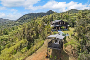
Finca Quebrada Seca is located in the mountains of Orocovis — about 20 minutes from Chorro de Doña Juana and within easy reach of the central mountain trails. If you’re planning a few days in the area and want a quiet place to return to, take a look at the property.